This is considered one of the best regions in one of the best countries for hiking + trekking. Here I have NOT included Parque Aconcagua. All options listed are free (there’s no fee for camping or accessing trails). To be fair, you’ll have to face costs for equipment if you don’t own gear and guides if you don’t know the area, but this applies only for the more ambitious treks. Excluding the first one, all require previous experience or some level of guidance. For my favourite, skip to the very end!
A QUICKIE: Cerro Arco (10 minutes drive from the city)
This is the Cerro with the antennas on top that you spot from the San Martín park. With a car it will take you 10 minutes to get here, with the bus (114-115 El Challao) 45′. I walked once, but it was a very long walk! It’s basic but good exercise and the way up is way more challenging (read: steep) than what you assume at first! If you’re in good shape it’s gonna take you almost 1 hour to get to the top, from where you’ll see the entire city. It is possible to do it by night with no torches when there is full moon. There is no shade, so wear sunscreen and a hat, especially in the summer. If you want to, you can continue to Santo Tomás (add one hour) and to Gateado (add 3 hours). Route here.
(HALF) DAY HIKES IF YOU SLEPT IN:
Cacheuta/La Crucesita/Las Compuertas Area (30 minutes drive)
Don’t underestimate this area! People have gotten lost for days before, the sierras can trick you as there are many lookalikes. Bring always lots of water, a torch – a gps tracking app might be a good idea (Wikiloc covers quite a lot here). In La Crucesita you have many full day options like Cerro Colorado Route here or Cerro Comisión in Cacheuta (trailhead behind el Rincón suizo, Route here) have a beautiful view of the Precordillera (Cordón del Plata) and paths are well marked so you don’t need a guide (but stick to the trails). Every time I’ve been here I’ve spotted condors. You’ll need around 3-4 hours to get to the top for most hikes (you can challenge yourself as I did and go with a friend who’s way more trained than you are – it’s fun for both for the first two hours!). Here you have a list of very attainable ‘classics’ of the area. These should all be free, even other similar hikes that pass through private property won’t imply fees, just sometimes an informal permit, which mostly means just asking and won’t even come into question if you’re less than 10 people.
The view from Cerro Comisión (Cacheuta) :


The view from Cerro Colorado (la Crucesita):


PLAN AHEAD: MEDIA/ALTA MONTAÑA:
Vallecitos Area (1.30 hour drive)
A map (coming soon, but this one is very pretty)

Here you have lots of options for different levels and two campsites, the first one is at 3200m (Veguitas) and the highest one (Piedra Grande) is at 3600m. Their main purpose is to let your body get used to the altitude. You’re in the Andes, camping is free! There is one toilet at the first campsite, which consists in a hole on the ground covered by a wood panel. Remember to put rocks to hold the tent: it gets very windy and I have seen a tent take off! There is a small river running next to the first campsite, where you can charge water. There are also different mountain refuges, but I’ve never slept in one. You’re supposed to register with Guardaparques and tell them when you’re back. The first times sleeping at high altitudes is common to experience some kind of anxiety, or to not sleep at all. I advice to bring always a – 20 (Celsius) sleeping bag, although in the summer it’s not (usually) essential. If you can’t afford it, you can rent it here. Also, you will need technical stuff at these altitudes – wind can make it feel like it’s 10 degrees less. Bring always two pairs of gloves + a torch + sunglasses + sunscreen + a pluma jacket (I can’t emphasise this enough, if you bring your snowboarding jacket you’ll freeze on the summit as I did the first time). Again, everything can be rented as mentioned earlier. For anything higher than San Bernardo (which itself is no joke) I feel you’ll need a guide or at least someone who’s been there before. The paths above 4000m are NOT well marked (there’s lots of acarreos* and animals make their own paths), you can use the mountains for orientation, but with bad weather (or snow) that can be tricky… All of that said… this is the real thing, views are quite impressive on top of these giants. From most peaks you can see Cerro El Plata, the highest mountain of this area, which has a distinctive shape and is in my opinion aesthetically the most beautiful of these summits. The drive to approach Veguitas is also really nice, passing Potrerillos and El Salto.
The Veguitas campsite at dusk:

*Just in case, this is what we mean by acarreos (me personally, I’d define it as a terrain composed only by rocks where finding or following a trail becomes ultimately difficult), but pictures should work better:


On the small snow piles you can sometimes appreciate animals’ footprints – sometimes pumas’, but direct encounters are more inexistent than rare.
View of the Ascensión to Cerros Adolfo Calle+ Stephanek:


Ascending Cerro Franke:

This is almost 5000m. It has 3 falsas cumbres, so you’ll only see the summit at the very end. I didn’t get to the top because I started having altitude sickness 100m before the summit. It wasn’t pleasant: it’s basically like a really bad hangover; you get nausea, a terrible headache, acceleated heartbeat. I had never had it before. It can happen to anyone, but you can diminish your chances by: 1) giving your body more time to get used to it – I should have camped in altitude two nights and not one; 2) drinking lots of water the days prior to the trek; 3) exercising regularly. Descending and an aspirin can help in these cases. Generally speaking, you don’t want to attempt something too extreme and you want to be equipped and informed on what you’ll be facing. That said, I’d encourage under the right conditions and if one has a fair amount of prior experience to dare a little – the best views come higher and with a little more effort. You’ll be laughing about what you were marvelling at at the beginning.
PLAN AHEAD: ALTA MONTAÑA: Penitentes area + Las Cuevas (over 2 hours driving from the city) ONLY FOR THE SUMMER
Las Cuevas
The furthest is in my opinion the most beautiful setting. Here you have some VERY SERIOUS hiking options – definitely higher than mine, be sure who your getting your infos from, might be an Everest climber – but there are some medium/advanced ones as well. The good thing here is that: there are buses (Butini or Andesmar) that can take you there and are reliable + there are affordable mountain hostels (I stayed in this one with a group and I recommend it; it has hot water and a kitchen and incidentally a churrasquera for asado as well!). Usually you don’t see much until you get to the top – but the view is quite breath-taking from above..
View from el Mirador del Tolosa:


Penitentes area
Arriving from Uspallata, just before Las Cuevas you’ll be at Penitentes. It’s a former ski station, but also the name of the mountain you’re facing. The erosion has shaped rocks like monks – that’s where the name comes from. It will take you (at least) two hours to get to the totally basic refugio (where you can camp), which is located at 3200m. From there you can climb Cerro Penitentes in 5 hours or explore other options as we did. There is absolutely no one here, you usually meet someone at the campsite, but that’s pretty much it, except for the casual Argentinian cow. There’s drinkable water (from the river) and cooking is also possible if you make a fire (there’s a grill). The scenery is absolutely beautiful and greener than usual: it’s similar to Parque Aconcagua, as it’s located in front of it. As the entire road connecting Potrerillos – Uspallata, the colors of the rocks opposed to the blue sky are quite fabulous. You’ll spot plenty of maras and condors in the area. Here specifically we had a very close encounter, as a condor flew just, I’d say less than 3m above us as we were napping halfway. At the base or by the road you’ll see lots of (abandoned) railroads: this is the railroad that connected Argentina (Buenos Aires) with Santiago; a documentary has been made about it.


A map:

You can also go right where the former ski station is (you’ll see the chairs) and have different trails that start there as well and are pretty relaxed in terms of physical condition. In that case you’ll be facing Cerro Penitentes, which is very beautiful:


General remarks
Check the weather forecast! You’ll need different shoes in altitude in case of snow – I’ve never tried them, they’re like rigid boots (they look a bit like skiing boots). I don’t use walking sticks, but everytime I’m in a group I’m the odd one out. Apps are more helpful than what you’d think: to check the weather you can use windy (wind above 20 can make it freezing cold in winter and give you a sunburn in the summer; although vehemently defended by its adepts, the app has failed at times, still I don’t have a better one to suggest). More than anything, I strongly advice to go with a guide or a local hiker and even if you’re experienced I wouldn’t suggest going alone above 3000m. There are many groups, local Club Andinista Mendoza and Tunuyán organize treks regularly at affordable rates – they’re Spanish speaking and are mostly addressed to locals, but are more than happy to meet foreigners and in my experience are excellent people – they always have people who are doing their practice to become mountain guides. For most treks it’s actually enough to hire a local guide or just to join a group with someone a little experienced. There are many excursion groups: I know guides from Hunuc and Mujeres a la cumbre. It’s not worth hiring a super pricey excursion, unless you’re really embarking on something technical, but most options requiere a vehicle. These mountains have no trees, which means: usually no water; no shade in the summer, exposure to the wind in winter, lots of rocks and acarreos, poorly marked paths and no terrain for compost to decompose itself – ideally you’ll leave nothing behind, even the fruits’ peel, otherwise these might freeze and contaminate the mountains. But don’t get scared, you’ll love them.
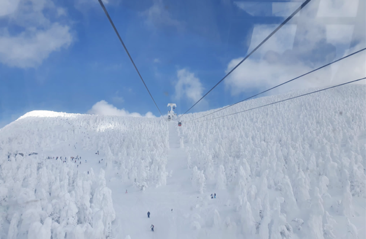
I haven’t experienced it covered with snow, but looks quite magical: